Wastewater DSS
"EI Technologies provides comprehensive GIS database design and development services for organizations."

Deteriorated wastewater lines have the potential to leak wastewater into the groundwater systems, resulting in groundwater contamination and environmental fines. These result in expensive remediation that can be avoided if the deterioration can be identified and mitigated early.
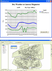
The tool allows municipal utilities to identify deteriorated wastewater infrastructure. It is used by engineers to analyze the spatial relationships of wastewater flow, hydrologic, and weather information. The tool analyzes wastewater transport in a combined open- and closed-system in order to identify line segments that receive input from external sources, which indicates the presence of breaks and cracks. Municipal utilities then use this information to more efficiently maintain their wastewater infrastructure, save time, and avoid regulatory fines.
Wastewater DSS uses the rainfall and snowmelt data to calculate input from human and atmospheric sources. If the calculated infiltration/inflow amounts are above a certain level then pipeline deterioration is probable for a pipe segment of interest.
Dashboard Visualization
The tool uses technology from Dundas Data Visualization, Inc. to create dashboard data displays to track flow rates, weather, and hydrologic conditions in areas of interest. The charts can be exported to industry-standard formats such as Adobe PDF for distribution to other managers and engineers in an organization.
